Jamaican Family Search Genealogy Research Library
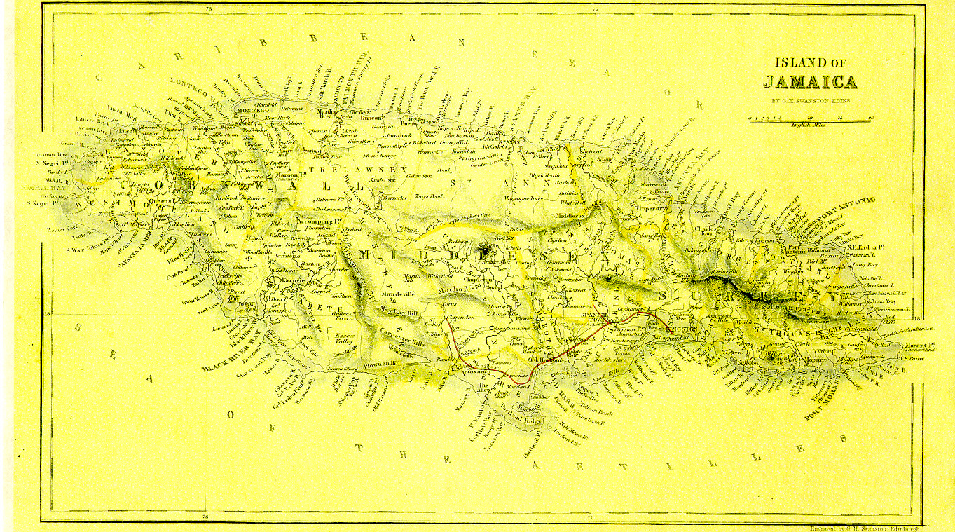
There was no date on this map. Jamaican Family Search assumed a date somewhere between 1840 and 1845. There is an anomaly. The map does not show the parish of Metcalf which was created in 1841, but it does show the railroad, which was built from Kingston to Spanish Town in 1845 and only later extended to the west. The cartographer appears to have superimposed the railroad on a map dated between 1815 and 1840.
SEARCH THIS SITE
GO TO:
Help - Frequently Asked Questions
Jamaica Almanacs Slave-owners, Civil & Military officers, Magistrates etc.
Items in the Samples Directory
Items in the Members Directory
Transcriptions from Registers and Wills (Church of England, Dissenters, Civil Registration)
Jamaican Roman Catholic Church Registers - transcriptions
Jamaican Methodist Baptisms - transcriptions
Jewish births marriages deaths - transcriptions