Jamaican Family Search Genealogy Research Library
MAPS OF KINGSTON 1894
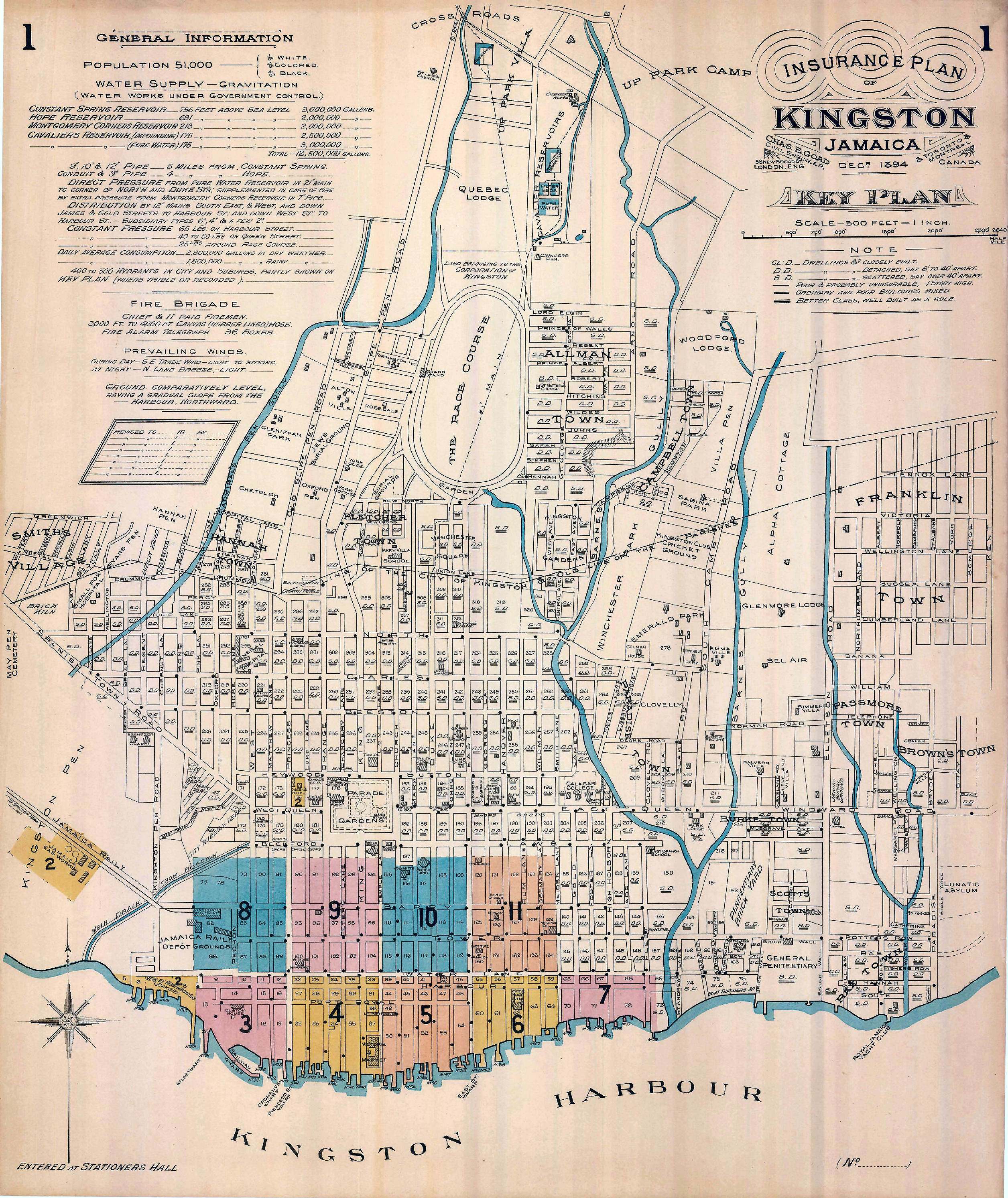
"INSURANCE PLAN OF KINGSTON 1894"
by Chas. E. Goad, Civil Engineer
PLEASE NOTE: These maps are large, and may load slowly. Your browser may initially show each map at the actual size, and then reduce it to fit the page. Click on the map to enlarge it again.
This is an overview map of Kingston, showing the names of all the streets, major landmarks (churches, synagogue, cemeteries, hospitals, hotels etc.). Sections of downtown Kingston are identified as being covered by very detailed maps, four of which are included here on this site. See Kingston Map 1
~~~~~~~~~~~~~
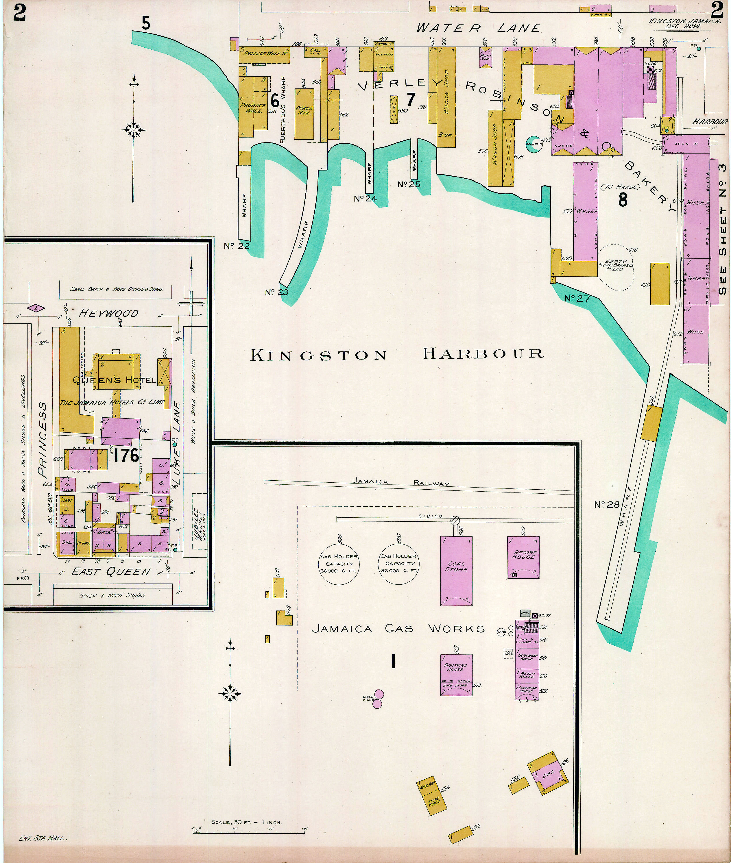
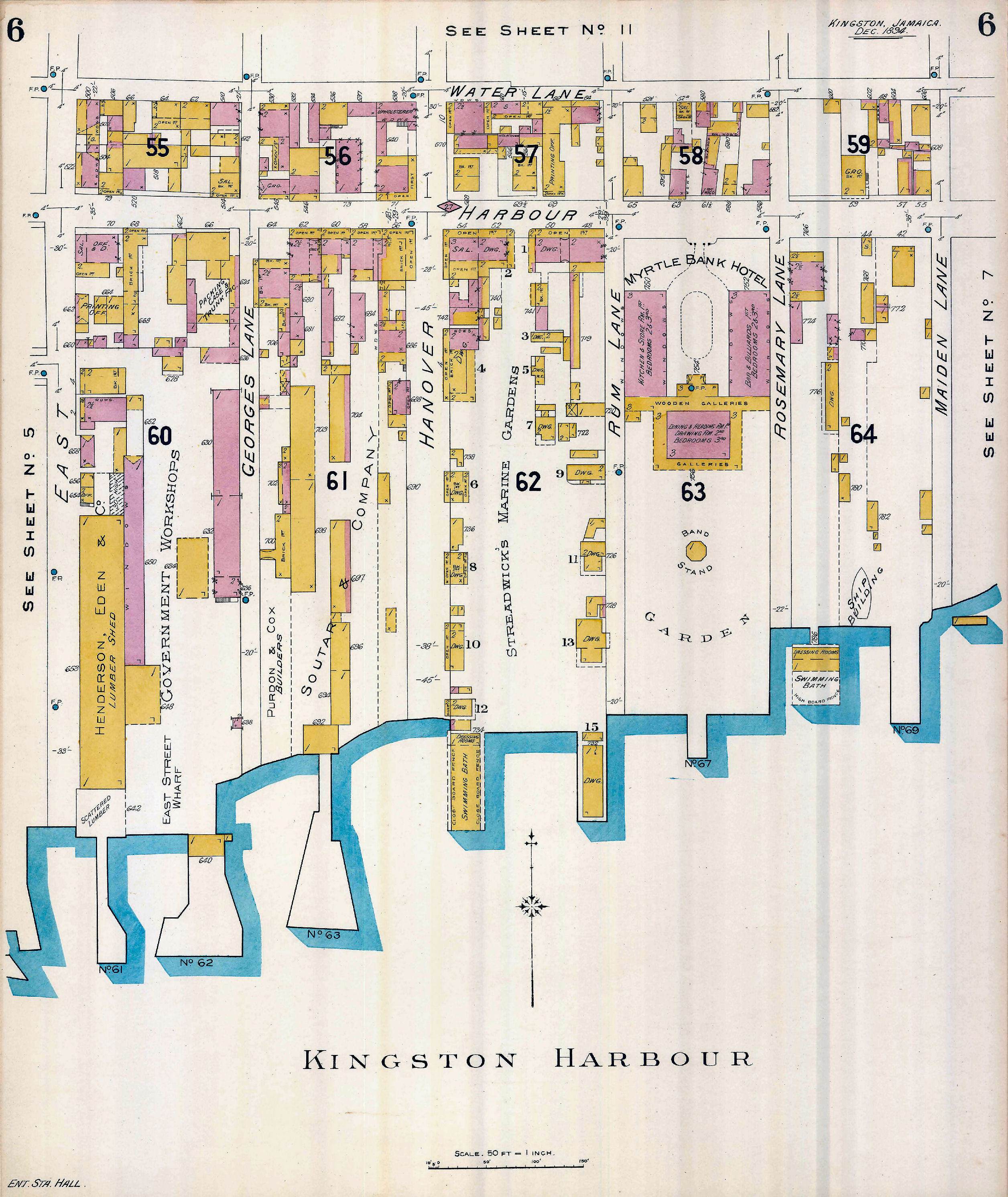
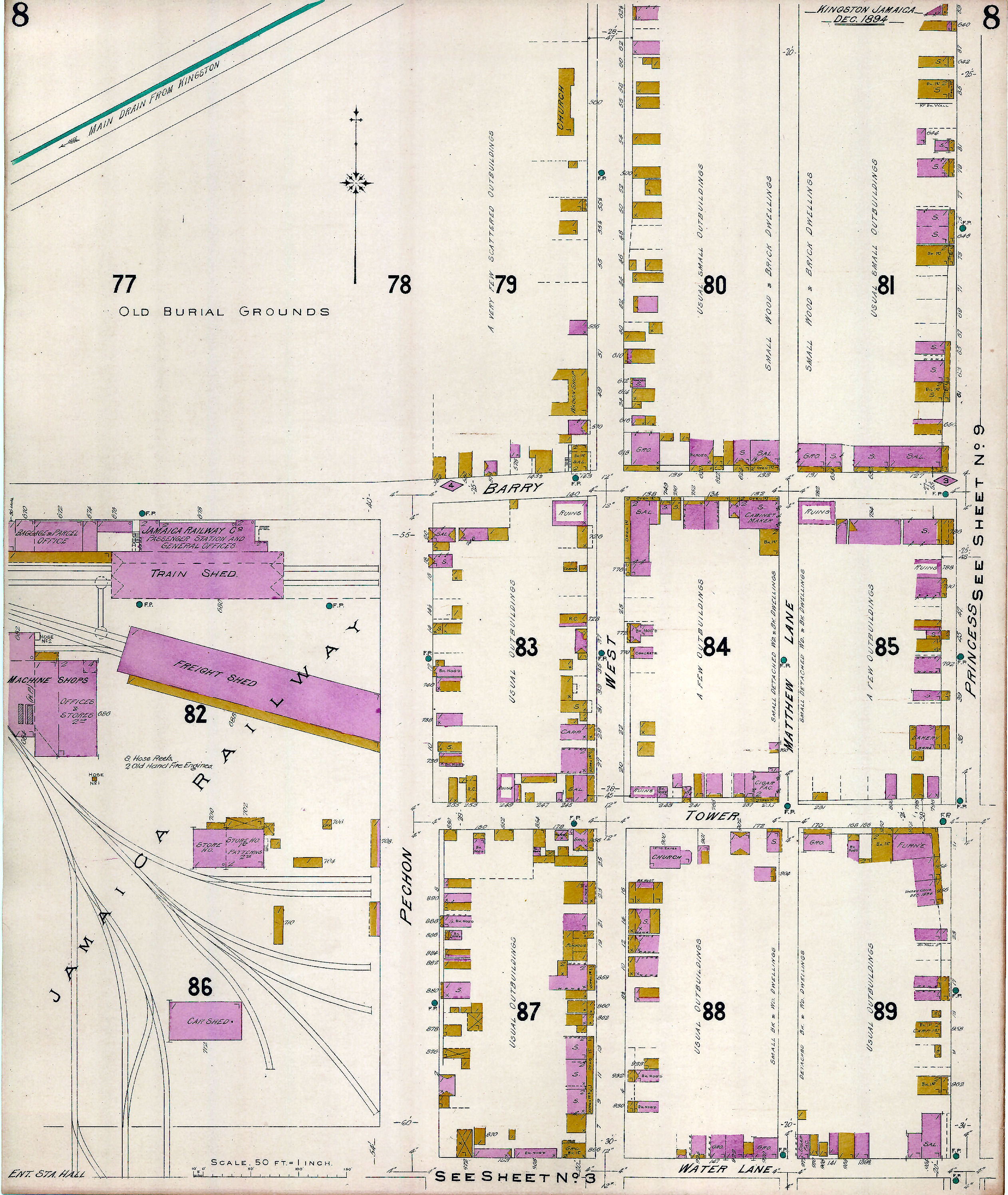
The detailed maps show the street address of each building, the type of construction, etc. The names of the owners of some business places are shown on the map. Others are identified by the type of business conducted at that address.
The detailed maps are:
- covering two sections: Princess Street east to Luke Lane, and from Heywood Street south to East Queen Street; and Water Lane south to the Harbour. See Kingston Map 2.
Some of the business owners identified on this map are: Feurtado and Verley Robinson & Co.
- covering Princess Street east to Temple Lane, and from Water Lane south to the Harbour. See Kingston Map 4.
Some of the business owners identified on this map are: D. Henderson, Aston W. Gardner, Emanuel Lyons, Pinnock, William Malabre, Arnold L. Malabre, J. C. Fegan, Turnbull, A. Munro, Davidson, Colhtirst, Finke, Simon, D. Finzi, M. Delgado, MacNish, J. H. McDowell.
- covering Temple Lane east to East Street, and from Water Lane south to the sea. See Kingston Map 5
Some of the business owners identified on this map are: Spicer & Clarke, Turnbull, Mudon, B. & J. B. Machado, J. Wray and Nephew, Lascelles deMercado, W. Lee, Feurtado, Charles Levy, Solomon Ashenheim, Emanuel Lyons, George and Branday.
- covering East Street east to Maiden Lane, and from Water Lane south to the sea. See Kingston Map 6
Some of the business owners identified on this map are: Henderson, Eden, Purdon, Cox, Soutar, Streadwick.
- covering the Railway yard and Pechon Street west to Princess Street, and from Water Lane north almost to Beckford Street. See Kingston Map 8.
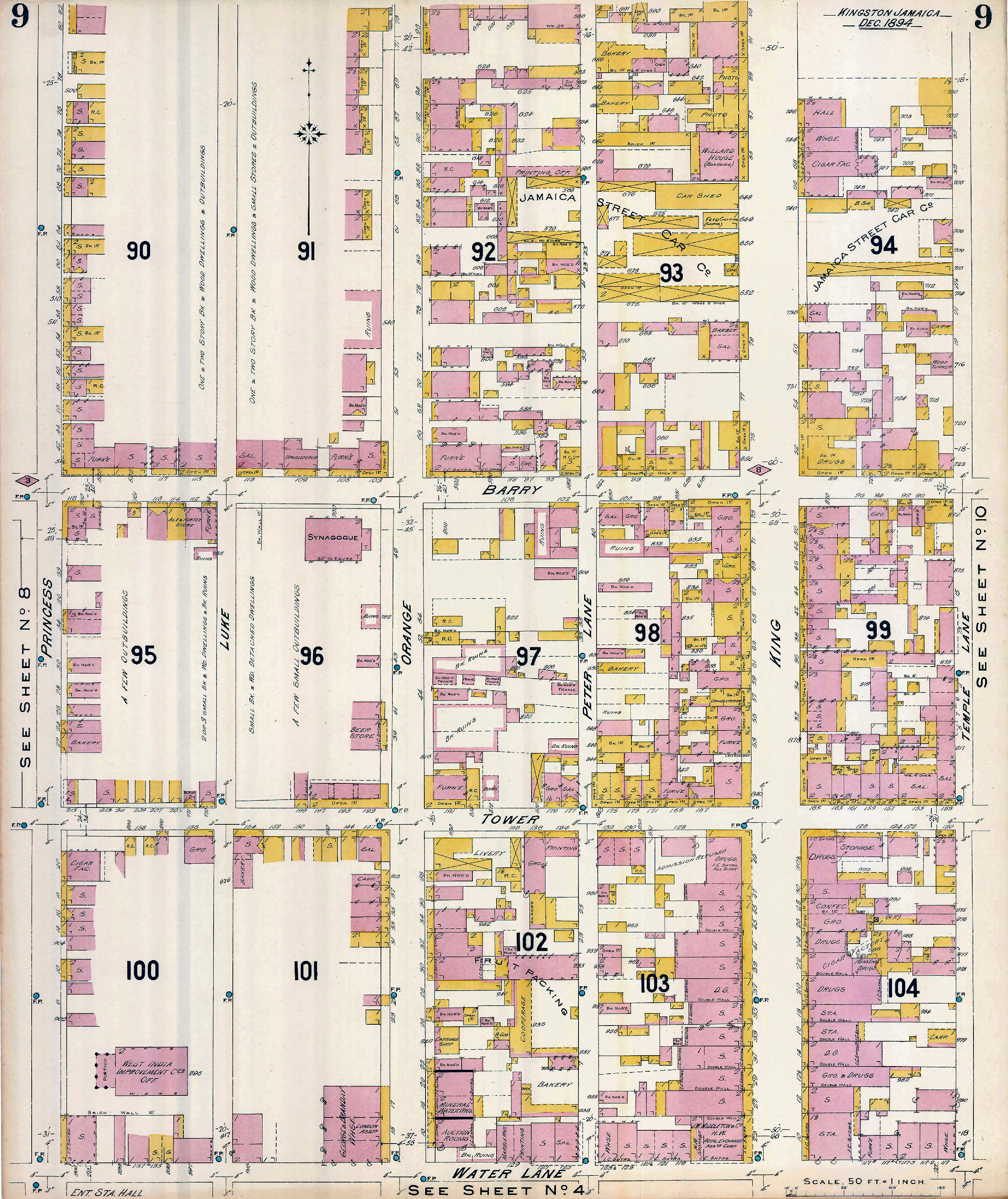
- covering Princess Street east to Temple Lane, and from Water Lane north almost to Beckford Street and Parade Gardens. See Kingston Map 9
Some of the business owners identified on this map are: Willard, J. W. Middleton, George and Branday.
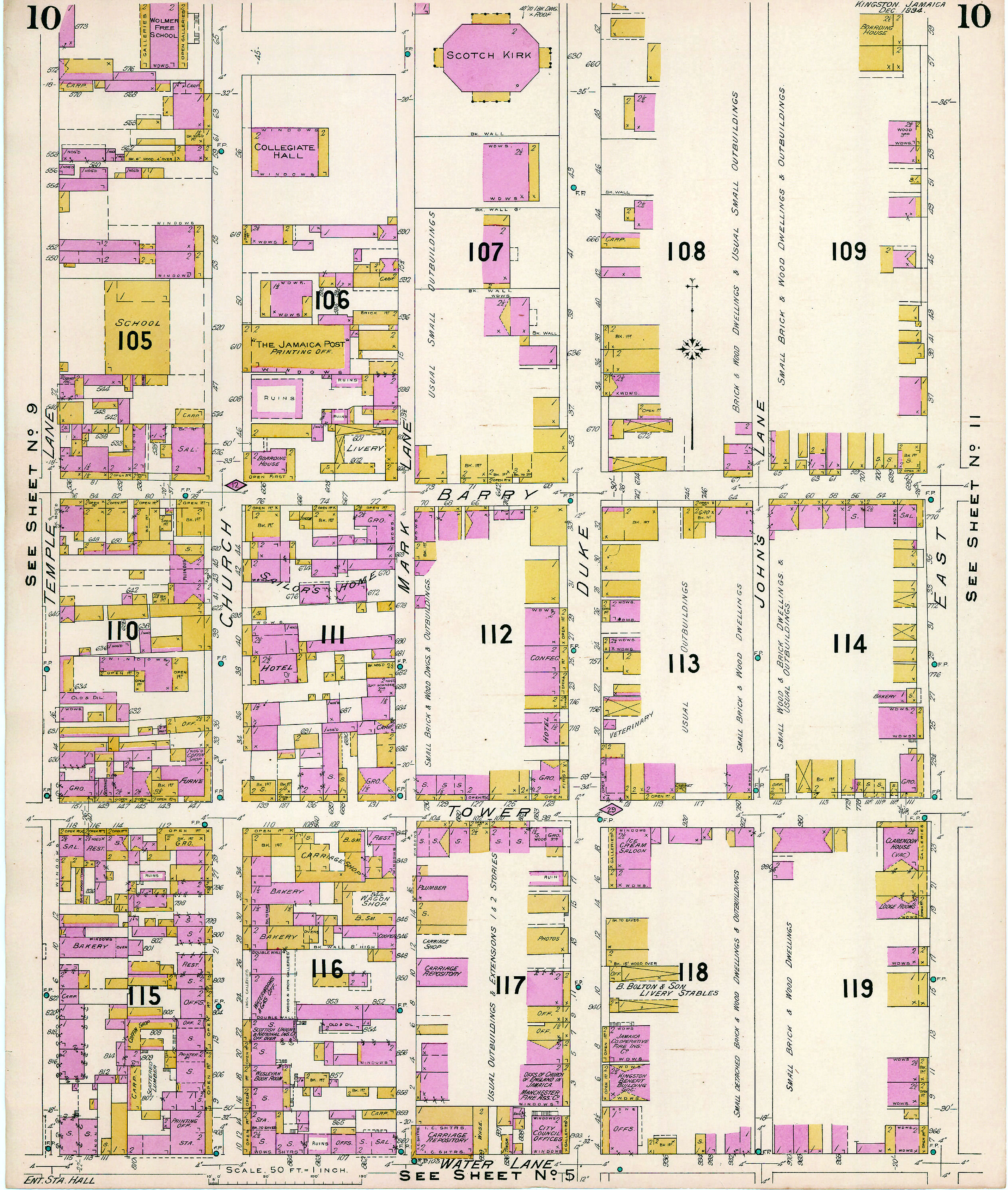
- covering Temple Lane west to East Street, and from Water Lane north almost to Laws Street. See Kingston Map 10.
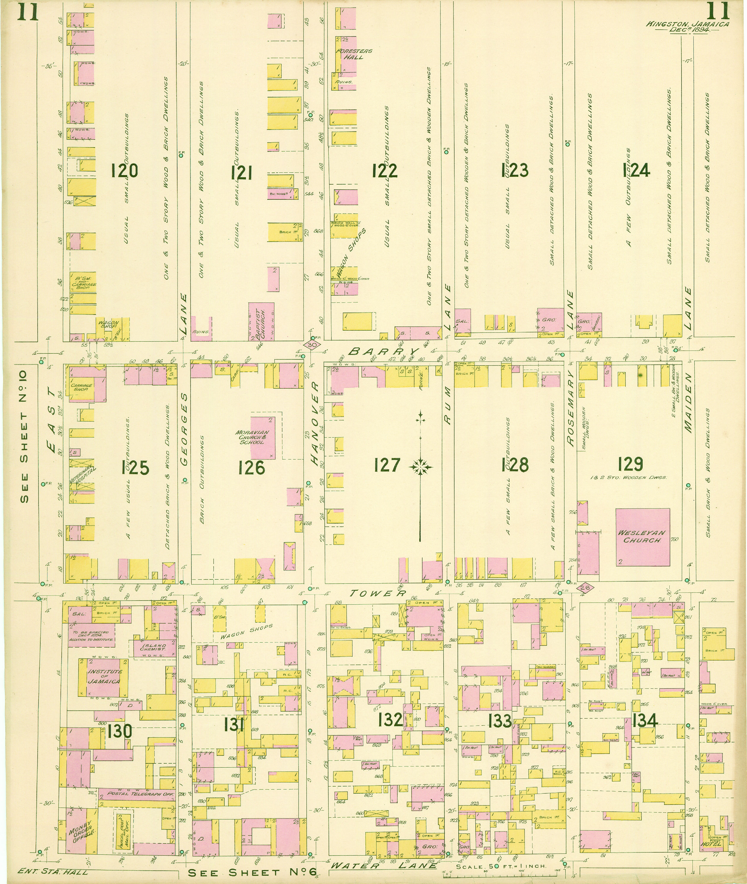
- covering Maiden Lane east to East Street, and from Water Lane north almost to Laws Street. See Kingston Map 11.
SEARCH THIS SITE
GO TO:
Help - Frequently Asked Questions
Jamaica Almanacs Slave-owners, Civil & Military officers, Magistrates etc.
Items in the Samples Directory
Items in the Members Directory
Transcriptions from Registers and Wills (Church of England, Dissenters, Civil Registration)
Jamaican Roman Catholic Church Registers - transcriptions
Jamaican Methodist Baptisms - transcriptions
Jewish births marriages deaths - transcriptions